Helping humankind live with the earth not against it

Author: katborealis (Page 16 of 28)

Borealis Meditation S02E02

Season 2 Episode 2 – Sumatra M8.6 and some other stuff!

Listen to me here

Show Notes: Sorry everyone! I am coming down with a cold and was SUPER tired when I recorded! That aside I still hope you enjoy the show!
Sumatra Quake USGS page: http://earthquake.usgs.gov/earthquakes/eqinthenews/2012/usc000905e/ Strike Slip Focal Mechanism
Normal Fault Focal Mechanism
Thrust Fault Focal Mechanism

NPR story page: http://www.npr.org/2012/04/11/150440356/quakes-caused-by-waste-from-gas-wells-study-finds

Say hi to Kate: @AnthroKate
Seismoscope from China: http://earthquake.usgs.gov/learn/eqmonitoring/eq-mon-6.php#earliest
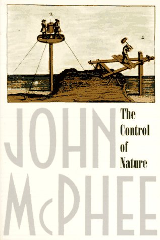
Control of Nature on Amazon: http://www.amazon.com/The-Control-Nature-John-McPhee/dp/0374522596
Questions:
– Old River Control Structure:

Lat:  31° 4’35.86″N
Long:  91°35’51.70″W

Questions:
– Before you read this section, did you have any thoughts or feelings about flood control systems and has that changed since you read this section? How about on the Mississippi?

– What are your feelings on the fact that we are keeping the Mississippi River in its current bed and not letting it migrate across the delta?

– What is the closest river or stream to where you live? Are there any man made modifications to it? How do you feel about it?

– What factors along the drainage and path of the Mississippi river have changed since the water flux for the Project Flood was calculated that add to the increase in flux of water through the lower Mississippi during high stands?

Blog: http://borealismeditation.blogspot.com
email: borealis.meditation@gmail.com facebook: http://www.facebook.com/pages/Borealis-Meditation/149460745070744 Shop: http://www.etsy.com/people/athenaspear and http://www.facebook.com/AthenaSpear


Borealis Meditation Season 2 Episode 1

This is the first episode for Season 2 (the season of slightly organized chaos)
of the Borealis Meditation Podcast

Listen and download the episode here
or from the itunes feed

The Main topic of this episode was Sonification of Data
The first featured data set was the 2011 earthquake catalog of events over Magnitude 4.5
[youtube http://www.youtube.com/watch?v=cwWn_W6ZbT4]

the audio segment I shared was from Feb 1 – April 15

Question 1) What can you hear about the change in world wide earthquakes after the Tohoku earthquake? What can you hear that might be hard to see in the data set if you were to pause the video on April 15th?

The next featured data set was star oscillations by the artist Jeff Talman. I played a segment of his piece Nature of the night sky (2011)

Please check out his website
Also check out the installations website
And the NPR interview
And please support this work by buying a CD from CD baby!

Here are the stars used and my brief descriptions.
KIC 7457184
KIC 2424822
KIC 6928997
KIC 8366239
KIC 6802438
KIC 11026764
KIC 9139151

Nu Indi – is a tight binary system. A blue-white +6.0 magnitude star is separated from a +6.1 magnitude yellowish-white star by only 0.1 seconds of arc.

Eta Bootis – a star in the conetallation Bootis and also has the traditional names of Muphrid and Saak

Procyon – brightest star in the constellation canis minor and is the seventh brightest star in the night sky

Mu Herculis – in the constellation Hercules and is in a system about 27.1 light years from earth

Beta Virginis – is a star in the constellation of virgo and has a traditional name of Zavihava and alaraph, it is the fifth star in order of brightness

49933 – a solar like star that is located about 98 light years from the sun in the constellation Monoceros the Unicorn

Alpha Centari B – brightest star in the constellation of Centaurus, it is a binary star system and only B was used in this recording

Tau Ceti – in the constellation Cetus and specrtally similar to the sun, centus is a sea monster in greek mythology and it is also often called the whale today

Borealis Meditation Book Club!
we are reading:
The Control of Nature by John McPhee (link to amazon but go to a local bookstore!)
Read Chapter 1 for next episode (end of March)

Kathleens random things:
– Egg seed starter
– runes
coconut bowls
and on etsy

Feedback requested:
Volcanoes and earthquakes you would like me to talk about
Regions where you live for geomorphology and rock hounding!

Thank you!

I just wanted to say thank you to everyone who has taken the time to email me.

You guys are wonderful. You guys are amazing.
Sounds like short episodes whenever I have the time are A-OK!
Also a few of you expressed interest in doing segments! I heard several people say they had thought about doing a podcast but didn’t have enough for a whole episode themselves! So let me know if you want to do a segment!
Also I heard to suggestion that I do more interviews and things with other podcasters (so they can edit hehehehehe) and then re-release those segments on my feed. I am totally up for that! Any takers podkin?
I just wanted to say thank you! 🙂

I need your feedback!

If you haven’t had the chance, please take a few minutes to listen to my mini-update. Please think about my questions and either shoot me an email or leave a comment! Thank you!

http://borealismeditation.podbean.com/2012/02/20/rambling-announcement-mini-update-thing/

food, health and trendy words.

I had a physical a few years ago, and my doctor is awesome and we talked about what I eat. I was told I am a semi-vegetarian meaning I eat a lot of veggies when I can, and fish and meat but not everyday. I found that phrase to be HI-LAR-IOUS! Well there is a new one. Flexitarian. Also makes me laugh. But it got me thinking about all those food boxes we put ourselves in and the meaning or the word diet. I follow a diet not to loose weight but to be healthy. To be honest it has no negative connotations for me. My diet changes as my environment changes.

In Alaska it is very hard to get fresh produce in the winter, but very easy in the summer. Based on that my diet changed from summer to winter. Here, there is a TON of fruit everywhere! So I eat a lot of fruit. I never thought about what to call my diets, I just did them. However, now that I am trying to change the dinner menu and actually make a menu I am finding (much to my chagrin) these trendy words make it easier to find new recipes. I want some balanced dinner ideas that are mostly vegetarian and you know what, looking for flexitarian dinners returns more of what I want.
Oh well, everything has a purpose right?
what sort of healthy snacks do you love? I love tomatoes! I like to eat them fresh with a little bit of salt! 🙂 Yum!

Feb 1-7 volcano activity report and significant earthquakes

Volcano & Earthquake Activity!

1 February-7 February 2012

New Activity/Unrest

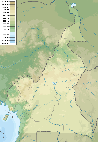
CAMEROON Cameroon 4.203°N, 9.170°E; summit elev. 4095 m
A news article stated that explosions from Mount Cameroon were observed by tourists who were in the area on 3 February. The tourists reported hearing strong explosions followed by observations of “flames” and ash.

new article

Geologic Summary:

Mount Cameroon, one of Africa’s largest volcanoes, rises to 4095 m above the coast of west Cameroon. The massive steep-sided volcano of dominantly basaltic-to-trachybasaltic composition forms a volcanic horst constructed above a basement of Precambrian metamorphic rocks covered with Cretaceous to Quaternary sediments. More than 100 small cinder cones, often fissure-controlled parallel to the long axis of the massive 1400 cu km volcano, occur on the flanks and surrounding lowlands. A large satellitic peak, Etinde (also known as Little Cameroon), is located on the southern flank near the coast. Historical activity, the most frequent of west African volcanoes, was first observed in the 5th century BC by the Carthaginian navigator Hannon. During historical time, moderate explosive and effusive eruptions have occurred from both summit and flank vents. A 1922 SW-flank eruption produced a lava flow that reached the Atlantic coast, and a lava flow from a 1999 south-flank eruption stopped only 200 m from the sea.

CLEVELAND Chuginadak Island 52.825°N, 169.944°W; summit elev. 1730 m

AVO reported that during 2-7 February cloud cover over Cleveland prevented views of the lava dome in the summit crater. The Volcano Alert Level remained at Watch and the Aviation Color Code remained at Orange. No current seismic information was available because Cleveland does not have a real-time seismic network.

Geologic Summary.
Symmetrical Mount Cleveland stratovolcano is situated at the western end of the uninhabited dumbbell-shaped Chuginadak Island in the east-central Aleutians. The 1,730-m-high stratovolcano is the highest of the Islands of Four Mountains group and is one of the most active in the Aleutians. Numerous large lava flows descend its flanks. It is possible that some 18th to 19th century eruptions attributed to Carlisle (a volcano located across the Carlisle Pass Strait to the NW) should be ascribed to Cleveland. In 1944 Cleveland produced the only known fatality from an Aleutian eruption. Recent eruptions from Mt. Cleveland have been characterized by short-lived explosive ash emissions, at times accompanied by lava fountaining and lava flows down the flanks.

KARKAR Northeast of New Guinea (SW Pacific) 4.649°S, 145.964°E; summit elev. 1839 m
Based on analyses of satellite imagery, the Darwin VAAC reported that a possible ash plume from Karkar rose to altitudes of 7.6-10.7 km (25,000-35,000 ft) a.s.l. and drifted NE and E on 1 February.

Geologic Summary.
Karkar is a 19 x 25 km wide, forest-covered island that is truncated by two nested summit calderas. The 5.5-km-wide outer caldera was formed during one or more eruptions, the last of which occurred 9000 years ago. The eccentric 3.2-km-wide inner caldera was formed sometime between 1500 and 800 years ago. Parasitic cones are present on the northern and southern flanks of basaltic-to-andesitic Karkar volcano; a linear array of small cones extends from the northern rim of the outer caldera nearly to the coast. Most historical eruptions, which date back to 1643, have originated from Bagiai cone, a pyroclastic cone constructed within the steep-walled, 300-m-deep inner caldera. The floor of the caldera is covered by young, mostly unvegetated andesitic lava flows.

PAPANDAYAN Western Java (Indonesia) 7.32°S, 107.73°E; summit elev. 2665 m
CVGHM lowered the Alert Level for Papandayan from 3 to 2 (on a scale of 1-4) on 31 January. No eruption details or reasons for the change were given in the report.

Geologic Summary.
Papandayan is a complex stratovolcano with four large summit craters, the youngest of which was breached to the NE by collapse during a brief eruption in 1772 and contains active fumarole fields. The broad 1.1-km-wide, flat-floored Alun-Alun crater truncates the summit of Papandayan, and Gunung Puntang to the N gives the volcano a twin-peaked appearance. Several episodes of collapse have given the volcano an irregular profile and produced debris avalanches that have impacted lowland areas beyond the volcano. Since its first historical eruption in 1772, in which a catastrophic debris avalanche destroyed 40 villages, only two small phreatic eruptions have occurred from vents in the NE-flank fumarole field, Kawah Mas.

SEMERU Eastern Java (Indonesia) 8.108°S, 112.92°E; summit elev. 3676 m

On 3 February, CVGHM reported that from 29 December 2011 to 2 February 2012 seismicity increased at Semeru, and dense white and gray plumes rose as high as 600 m above the Jonggring Seloko crater. During the month of January crater incandescence was observed and avalanches carried incandescent material 200-400 m away from the crater. On 2 February a large explosion was reported and incandescent material was ejected 2.5 km from the crater. Based on the seismic activity and visual observations, CVGHM raised the Alert Level from 2 to 3 (on a scale of 1-4) on 2 February.

Geologic Summary.
Semeru is the highest volcano on Java and one of its most active. The symmetrical stratovolcano rises abruptly to 3,676 m above coastal plains to the S and lies at the southern end of a volcanic massif extending N to the Tengger caldera. Semeru has been in almost continuous eruption since 1967. Frequent small-to-moderate Vulcanian eruptions have accompanied intermittent lava dome extrusion, and periodic pyroclastic flows and lahars have damaged villages below the volcano. A major secondary lahar on 14 May 1981 caused more than 250 deaths and damaged 16 villages.

TUNGURAHUA Ecuador 1.467°S, 78.442°W; summit elev. 5023 m

IG reported a new episode of activity from Tungurahua on 4 February with an explosion that produced roaring heard 14 km NW in Palitahua and Guadalupe. On 4 February an ash plume rose to altitudes of 7-8 km above the crater and drifted NE; lapilli fall was reported in Baños (9 km N), Pillate (7 km W), and Juive (7 km NNW). IG staff aboard a commercial flight on 4 February observed an ash plume that rose to an altitude of 1 km above the crater and drifted W. Ashfall and roaring noises were reported in Baños, Pillate, Juive, Pondoa (8 km N), Pelileo ( about 7 km NW), Guadalupe, Cevallos (23 km NW), and Patate (NW). A pyroclastic flow descended into the Achupashal drainage (NW). At night incandescent blocks ejected by an explosion traveled 1 km down the flanks. On 5 February clouds prevented views of the volcano, though loud “cannon shots” were heard in Baños and Juive, and ashfall was reported in Manzano (8 km SW). Clouds prevented views of the volcano during 6-7 February.

Geologic Summary.

The steep-sided Tungurahua stratovolcano towers more than 3 km above its northern base. It sits ~140 km S of Quito, Ecuador’s capital city, and is one of Ecuador’s most active volcanoes. Historical eruptions have all originated from the summit crater. They have been accompanied by strong explosions and sometimes by pyroclastic flows and lava flows that reached populated areas at the volcano’s base. The last major eruption took place from 1916 to 1918, although minor activity continued until 1925. The latest eruption began in October 1999 and prompted temporary evacuation of the town of Baños on the N side of the volcano.


dual purpose everything.

Now, I have no citations for this post, this is all opinion. Disclaimer over, here I go!

Dual purpose tools. It is my opinion that the modern witchcrafting tools are derived from common everyday tools, herbs, and supplies. Things that were common to the area the witch lived, and common around the house. Everyone had a cauldron or some sort of large vesicle in the hearth, because that is how things were cooked. Mortar and pestle and knives were common place objects in the kitchen. Even the herbs and curios were plants, animals and things found in the environment. Witches were not rich, they were thrifty! They used the tools already around them! That is how I choose to view things, and how I run my practice. Use what you have, find what you need, no need to break the bank.
I would like to then talk to you about my latest project. Coconut bowls. I have been updating on twitter about the progress of my beauties but I wanted to run through some of the rational and uses for them.
I am currently finishing the inside with a food safe butcher block oil and finish. Why? Because it is important to me that they be dual purpose! These bowls can be used as, bowls, cups (as is done at the Kava bar), decor for the house, and offering bowls for my alter (their original purpose). So while I did not need to make them food safe to use them as offering bowls, since I would also like them to be water safe and food safe I took a few extra steps in finishing them.
My alter in fact is more of the garden window. My God and Goddess candles moonlight as either decor for the mantle or for the dining room table. My mortar and pestle while used for craft workings live in my kitchen, and my incense burner moves around the house. As a geologists I always have rocks out so they just sort of rotate through. My garden window is my favorite nook in my place, and yes I do move things around and pull out some special items when I do any workings… but, it is dual purpose. I currently have herbs and vegetable starts in the window soaking up the sun.
I would love to hear your thoughts on dual purpose tools!

Activity update: volcanoes and earthquakes Thrusday night 2/2/2012

I’m lazy tonight so a lot of paste copy here!

Volcanic Activity

25 January-31 January 2012 Volcano Activity Report!
New Activity/Unrest:
CLEVELAND Chuginadak Island 52.825°N, 169.944°W; summit elev. 1730 m
AVO reported that on 31 January the Volcano Alert Level for Cleveland was raised to Watch and the Aviation Color Code was raised to Orange due to the formation of a new 40-m-wide lava dome in the summit crater that was observed in satellite imagery on 30 January. The lava dome that formed during the past fall and winter was removed by explosive activity on 25 and 29 December 2011. No current seismic information was available because Cleveland does not have a real-time seismic network.
Geologic Summary. Symmetrical Mount Cleveland stratovolcano is situated at the western end of the uninhabited dumbbell-shaped Chuginadak Island in the east-central Aleutians. The 1,730-m-high stratovolcano is the highest of the Islands of Four Mountains group and is one of the most active in the Aleutians. Numerous large lava flows descend its flanks. It is possible that some 18th to 19th century eruptions attributed to Carlisle (a volcano located across the Carlisle Pass Strait to the NW) should be ascribed to Cleveland. In 1944 Cleveland produced the only known fatality from an Aleutian eruption. Recent eruptions from Mt. Cleveland have been characterized by short-lived explosive ash emissions, at times accompanied by lava fountaining and lava flows down the flanks.

Source: Alaska Volcano Observatory (AVO)

GAMALAMA Halmahera 0.80°N, 127.33°E; summit elev. 1715 m
CVGHM lowered the Alert Level for Gamalama from 3 to 2 (on a scale of 1-4) on 24 January based on visual observations of white plumes rising as high as 100 m above the crater and a decrease in seismicity since the last eruption on 23 December 2011.
Geologic Summary. Gamalama (Peak of Ternate) is a near-conical stratovolcano that comprises the entire island of Ternate off the western coast of Halmahera and is one of Indonesia’s most active volcanoes. The island of Ternate was a major regional center in the Portuguese and Dutch spice trade for several centuries, which contributed to the thorough documentation of Gamalama’s historical activity. Three cones, progressively younger to the N, form the summit of Gamalama, which reaches 1,715 m. Several maars and vents define a rift zone, parallel to the Halmahera island arc, that cuts the volcano. Eruptions, recorded frequently since the 16th century, typically originated from the summit craters, although flank eruptions have occurred in 1763, 1770, 1775, and 1962-63.
KRAKATAU Indonesia 6.102°S, 105.423°E; summit elev. 813 m
CVGHM lowered the Alert Level for Anak Krakatau from 3 to 2 (on a scale of 1-4) on 26 January. No details or reasons for the change were given in the report.
Geologic Summary. Renowned Krakatau volcano lies in the Sunda Strait between Java and Sumatra. Collapse of the ancestral Krakatau edifice, perhaps in 416 AD, resulted in a 7-km-wide caldera. Remnants of this volcano formed Verlaten and Lang Islands; subsequently Rakata, Danan and Perbuwatan volcanoes were formed, coalescing to create the pre-1883 Krakatau Island. Caldera collapse during the catastrophic 1883 eruption destroyed Danan and Perbuwatan volcanoes, and left only a remnant of Rakata volcano. The post-collapse cone of Anak Krakatau (Child of Krakatau), constructed within the 1883 caldera at a point between the former cones of Danan and Perbuwatan, has been the site of frequent eruptions since 1927.
LEWOTOLO Lomblen Island (Indonesia) 8.272°S, 123.505°E; summit elev. 1423 m
On 25 January CVGHM lowered the Alert Level for Lewotolo from 3 to 2 (on a scale of 1-4) based on decreased seismicity and visual observations during 5-15 January. During 5-15 January fumarolic plumes rose 200-500 m above the summit and incandescence was observed.
Geologic Summary. Anchoring the eastern end of an elongated peninsula that is connected to Lomblen Island by a narrow isthmus and extends northward into the Flores Sea, Lewotolo rises to 1,423 m. Lewotolo is a symmetrical stratovolcano as viewed from the N and E. A small cone with a 130-m-wide crater constructed at the SE side of a larger crater forms the volcano’s high point. Many lava flows have reached the coastline. Historical eruptions, recorded since 1660, have consisted of explosive activity from the summit crater.
NYAMURAGIRA Democratic Republic of Congo 1.408°S, 29.20°E; summit elev. 3058 m
The VolcanoDiscovery Team observed the fissure eruption at Nyamuragira that began on 6 November 2011 during 22-25 January 2012 from the newly formed cinder cones located about 10 km E of the summit crater. They reported three coalescent cones with the largest cone containing a small lava lake. The lake ejected spatter every few seconds as high as 200 m above the summit; individual bombs reached the base of the cone. Lava flows from the vent extended several kilometers N. Numerous small breakouts formed secondary flows, and a large breakout about 2 km N of the cone fed a large lava flow about 20 m wide. Burning forests were reported to the NNE.
Geologic Summary. Africa’s most active volcano, Nyamuragira (Also spelled Nyamulagira) is a massive basaltic shield volcano N of Lake Kivu and NW of Nyiragongo volcano. Lava flows from Nyamuragira cover 1,500 sq km of the East African Rift. The 3058-m-high summit is truncated by a small 2 x 2.3 km summit caldera that has walls up to about 100 m high. About 40 historical eruptions have occurred since the mid-19th century within the summit caldera and from numerous fissures and cinder cones on the volcano’s flanks. A lava lake in the summit crater, active since at least 1921, drained in 1938. Twentieth-century flank lava flows extend more than 30 km from the summit, reaching as far as Lake Kivu.

Source: VolcanoDiscovery

PALUWEH Lesser Sunda Islands (Indonesia) 8.32°S, 121.708°E; summit elev. 875 m
Seismic activity from Paluweh (also known as Rokatenda) increased during 12-18 January, prompting CVGHM to raise the Alert Level from 1 to 2 (on a scale of 1-4) on 19 January. Fog prevented visual observations of the volcano.
Geologic Summary. Paluweh volcano, also known as Rokatenda, forms the 8-km-wide island of Paluweh N of the volcanic arc that cuts across Flores Island. Although the volcano rises about 3,000 m above the sea floor, its summit reaches only 875 m above sea level. The broad irregular summit region contains overlapping craters up to 900 m wide and several lava domes. Several flank vents occur along a NW-trending fissure. The largest historical eruption of Paluweh occurred in 1928, when a strong explosive eruption was accompanied by landslide-induced tsunamis and lava-dome emplacement.
Ongoing Activity: | Dukono, Halmahera | Etna, Sicily (Italy) | Hierro, Canary Islands (Spain) | Karymsky, Eastern Kamchatka (Russia) | Kilauea, Hawaii (USA) | Kizimen, Eastern Kamchatka (Russia) | Pagan, Mariana Islands | Popocatépetl, México | Puyehue-Cordón Caulle, Central Chile | Sakura-jima, Kyushu | Santa María, Guatemala | Shiveluch, Central Kamchatka (Russia) | Soufrière Hills, Montserrat
Significant Earthquakes

What the frack is causing those earthquakes!?

There has been a lot of worry recently about hydraulic fracturing in the hunt for natural gas and the idea that it causes earthquakes. A lot of geologists have been writing on this topic and since they have done a far better job than I can, I am going to refer you to some good reading on the topic. Because the short answer is I am not sure how to answer this question!

(Earthquake is defined by the dictionary of geologic terms as: a sudden motion or trembling in the earth caused by the abrupt release of slowly accumulated strain.)
To start off I recommend a post written for the volcanocast blog titled “No Fracking Earthquakes” I like the explanation of the basics in this one. Also read the comments!
The next post that I would recommend is “A short FAQ on earthquakes and fracking” from the Highly Allochthonous blog. The question/answer I want you to focus on is “They’re certainly a lot bigger…”
Ok now for some other reading:
First I want to point your attention to a USGS Study titled “Examination of Possibly Induced Seismicity from Hydraulic Fracturing in the Eola Field, Garvin County, Oklahoma” [PDF]
one last on topic blog post from the dynamic earth “Frickin’ Fracking
If in this reading you want something clarified or explained leave a comment or email me!
« Older posts Newer posts »

© 2026 Kathleen Borealis

Theme by Anders NorenUp ↑